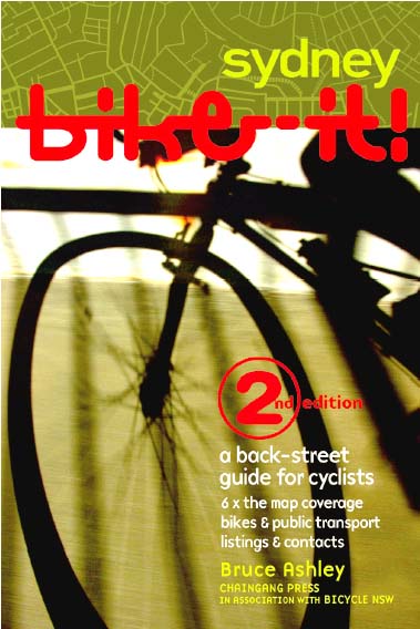
Bike-it! Sydney 2nd Edition
Bike-it! Sydney 2nd Edition was a high quality mapping guide to the safer and quieter bike routes through the maze of Sydney Streets. You got to see all the shortcuts on the quietest and best available pathways, bike lanes and quiet streets! You can become more confident riding in Sydney!
The guide included the following features:
• 48 high resolution vector (scale able) colour cycling maps of inner sydney. The maps coverage is from Burwood in the West to the coast, and from Chatswood in the North down to Rockdale in the South
• the detailed (vector-based) maps show: all the suggested back-street bicycle routes; hills and steepness category on routes and alternate routes to avoid hills; intersections with traffic lights, pedestrian crossings, off-road pathways and plazas, footpath routes; CityRail and Light Rail lines, train stations, ferry stops, and best access points; location of bike shops and shopping precincts, open space areas etc..
• location is also shown for: off-road bike circuits and bike lockers, police stations, hospitals, tourist info centres, swimming pools, skate parks, Council offices, Goget carshare pods, schools, lifts
• detail listings for bike shops, government agencies and councils, bike groups and places to buy bike gear, internet sites, and references for further reading• plenty of information to help you get going on two wheels: learning to ride a bike, night riding, rules and law as for bike riders, using public transport and dual-mode, and riding tips for riding in the city and in traffic
Unfortunately, after just talking up the book, Bike-it! Sydney 2nd Edition has now sold out of print copies. You may be very lucky to find a new copy for sale in a bike shop or bookshop, but the best chance would be is via the second-hand book market at book shops or online such as Gumtree or Abebooks.
But, you are in luck if a soft copy is what you are after! View a PDF of Bike-it! Sydney 2nd Edition below or download a PDF file copy.
For those that are itching to have a full size hard copy Bike-it! map 1.5 metres x 2 metres please contact Bruce to arrange a custom printing. This map combines all the book pages into a single map and includes cycling facilities built up to and including 2016 and for a slightly expanded map coverage compared with the 2005 edition. This full-size “3rd edition” map could also be printed as a transparency to be placed a large corporate or shop window for instance.